A project of

RICE logo
  • Rice is a type of grass (genus Oryza) that belongs to a family of plants that includes other cereals such as
    Read More

    Rice as a plant

  • Rice is the most important human food crop in the world, directly feeding more people than any other crop. In 2012,
    Read More

    Rice as a crop

  • Cultivating rice is the – and source of income – for millions of households around the globe. Rice is grown in more than
    Read More

    Rice as commodity

  • Rice is the most important food crop of the developing world and the staple food of more than half of the
    Read More

    Rice as food

  • Challenges

    Challenges

    For every one billion people added to the world’s population, 100 million more tons of rice need to be produced each year. But the challenges facing rice production are great. Read More
  • Culture

    Culture

    Rice is a central part of many cultures – some countries even credit rice cultivation with the development of their civilization. It is remarkable that almost every culture has its own way of harvesting, processing and eating rice and these different traditions are, in fact, part of the world's cultural heritage. Read More
  • Rice around the world

    Rice around the world

    Following are detailed descriptions of selected rice-producing countries in rice regions (Asia, Latin America and the Caribbean [LAC], Africa, North America, and Europe). Of the top 10 countries in the world during 2005-09, nine are in Asia, in order: China, India, Indonesia, Bangladesh, Vietnam, Myanmar, Thailand, Philippines, and Japan. Completing the top 10 Asian countries is Cambodia. Read More
liberia

General information

  • GNI per capita at PPP$, 2011: 540
  • Internal renewable water resources, 2011: 200 km3/year
  • Incoming water flow, 2011: 32 km3/year
  • Main food consumed, 2009: cassava, rice, bananas and plantains, vegetables including oils, wheat, sugar, meat
  • Rice consumption, 2009: 96.1 kg milled rice per person per year

Production season


Planting

Harvesting

Main
Apr-Jul
Sep-Dec


Write-up taken from the IRRI's Rice Almanac (2013):


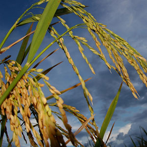
Liberia, whose coast is known as the Grain Coast, faces the Atlantic Ocean in West Africa, occupying 111,370 km2 between Sierra Leone and Côte d’Ivoire, with a population of 4.1 million (2011). There are low-lying coastal plains where most crops, including rice, are grown, and a mountainous interior with central plateaus. Arable land is less than 5% of the land area, but agriculture contributes 53.1% to the country’s GDP and occupies less than two-thirds of the workforce.

Source: FAOSTAT database online and AQUASTAT database online, as of November 2012.


Return to world map

guinea-bissau

General information

  • GNI per capita at PPP$, 2011: 1,240
  • Internal renewable water resources, 2011: 16 km3/year
  • Incoming water flow, 2011: 15 km3/year
  • Main food consumed, 2009: rice, starchy roots, plantains, millet and sorghum, milk, vegetables including oils, meat
  • Rice consumption, 2009: 99 kg milled rice per person per year

Production season


Planting

Harvesting

Main
May-Aug
Oct-Jan


Write-up taken from the IRRI's Rice Almanac (2013):


Guinea Bissau is a tiny tropical West African country of 28,120 km2 land area, facing the Atlantic Ocean between Senegal and Guinea. The land is mainly flat, rising to savanna in the east. The population in 2011 was 1.6 million. Rice is grown in both swampy coastal areas and the drier savanna region. About 11% of the land is arable and agriculture, which occupies 79% of the workforce, constitutes 57.3% of GDP (2009).

Source: FAOSTAT database online and *RICEINFO, as of November 2012.


Return to world map

guinea

General information

  • GNI per capita at PPP$, 2011: 1,020
  • Internal renewable water resources, 2011: 226 km3/year
  • Incoming water flow, 2011: 0 km3/year
  • Main food consumed, 2009: starchy roots, rice, vegetables including oils, plantains, fruits, wheat
  • Rice consumption, 2009: 105.8 kg milled rice per person per year

Production seasons


Planting

Harvesting

Main
Apr-Jun
Sep-Nov
Off
Dec-Feb
Apr-Jun


Write-up taken from the IRRI's Rice Almanac (2013):


Guinea is a populous country (population 10.2 million in 2011) of West Africa, facing the Atlantic Ocean between Guinea Bissau and Sierra Leone. The majority of the population lives on a hot, humid coastal plain, where rice and other crops are grown. There is a central mountainous region and a drier northeastern area where maize and similar crops are cultivated. Arable land is 11.6% of the land area of 245,720 km2. Some 80% of the workforce is agricultural, yet agriculture made up only 22.1% of GDP in 2011.

Source: FAOSTAT database online and AQUASTAT database online, as of November 2012.


Return to world map

General information

  • GNI per capita at PPP$, 2011: 1,810
  • Internal renewable water resources, 2011: 30.3 km3/year
  • Incoming water flow, 2011: 22.9 km3/year
  • Main food consumed, 2009: starchy roots, plantains, vegetables including oils, fish, rice, maize, wheat
  • Rice consumption, 2009: 26.9 kg milled rice per person per year

Production seasons


Planting

Harvesting

Main
May-Jun
Oct-Nov
Off
Jan-Feb
May-Jun


Write-up taken from the IRRI's Rice Almanac (2013):


The Republic of Ghana, a small (238,540 km2) tropical West African country bordering the Gulf of Guinea in the Atlantic Ocean, is predominantly agricultural (25.6% of GDP in 2011), with 55% of the workforce employed in agriculture on wide savannas in the north and cleared rainforest in the south. Arable land is 19.3% of the land area. Deforestation and desertification are of increasing concern. The population in 2011 was 25.0 million.

Source: FAOSTAT database online and AQUASTAT database online, as of November 2012.


Return to world map

If you want to learn more, please read the Rice Almanac. You can purchase it on Kindle or download for free as a PDF.

In partnership with:

IRRI-logo
logo-africarice
CIAT-logo